Monday 30 November – Day 16
27 km, felt like 50
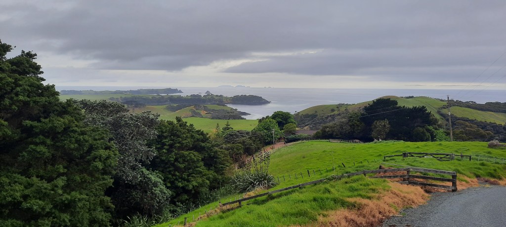
Ros and Hugh gave us a delicious breakfast this morning. One for champions; fruit cereal toast bacon eggs tea and coffee. Their visitor book is full of glowing acknowledgements from grateful hikers. We all bundled into their van and set off across to the other side of the estuary. This morning they were going into Whangarei so rather than row us across with a high tide we were driven. There were hugs all round as Jazz was accompanying them into the city to see a Dr about her foot. We three set off up the road leading to the Kauri Mountain track. Presumably it was covered in kauri trees in the past before they became houses and furniture. Fortunately there are still some specimens planted so it can retain its title. Shortly up the road a lady is standing at a letterbox looking into the paddock. She directs our gaze to a horse and a white infant foal, a matter of hours old. She was waiting to see if the mare would let it suckle. Apparently the horse was too young to have a foal so something went awry a year or so ago. The view as we climbed ever higher was widespread. We could trace the coast we had previously walked, see the Poor Knights Islands and admire the lifestyle blocks that adorn the mountain. I say adorn as every block is well tended and features a fine house. Private signs abound. The final track to the summit is through a narrow slash of gorse then we make it to the trig. For the first time the rest of the day unfolds before us – Ocean beach and the daunting outcrop of the Whangarei Heads. The track descended through bush where a road led us via a farm to the start of the beach. In contrast to the northern side of the mountain, the farm had gorse everywhere and the fences were mostly nonexistent. Once on Ocean beach we had a 6 km to get to the other end. The tide had been high and was going out however the hard sand was still at the waters edge. The water was crystal clear with uniform waves that every so often would surprise us by washing further up the beach. I got my shoes soaked at least three times. After all what’s the TA without wet feet?! We arrived at the Ocean Beach settlement before midday and stopped at the TA campsite for lunch and water. We had been debating whether to stay here the night or go across the heads. As we were early in the day we all concurred that we should get it out of the way this afternoon. It is 7.5 km and takes 5-6 hours so it will be lateish by the time we get to camp thsi evening, wherever that may be.

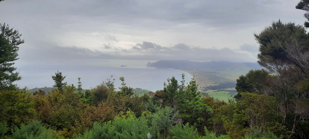

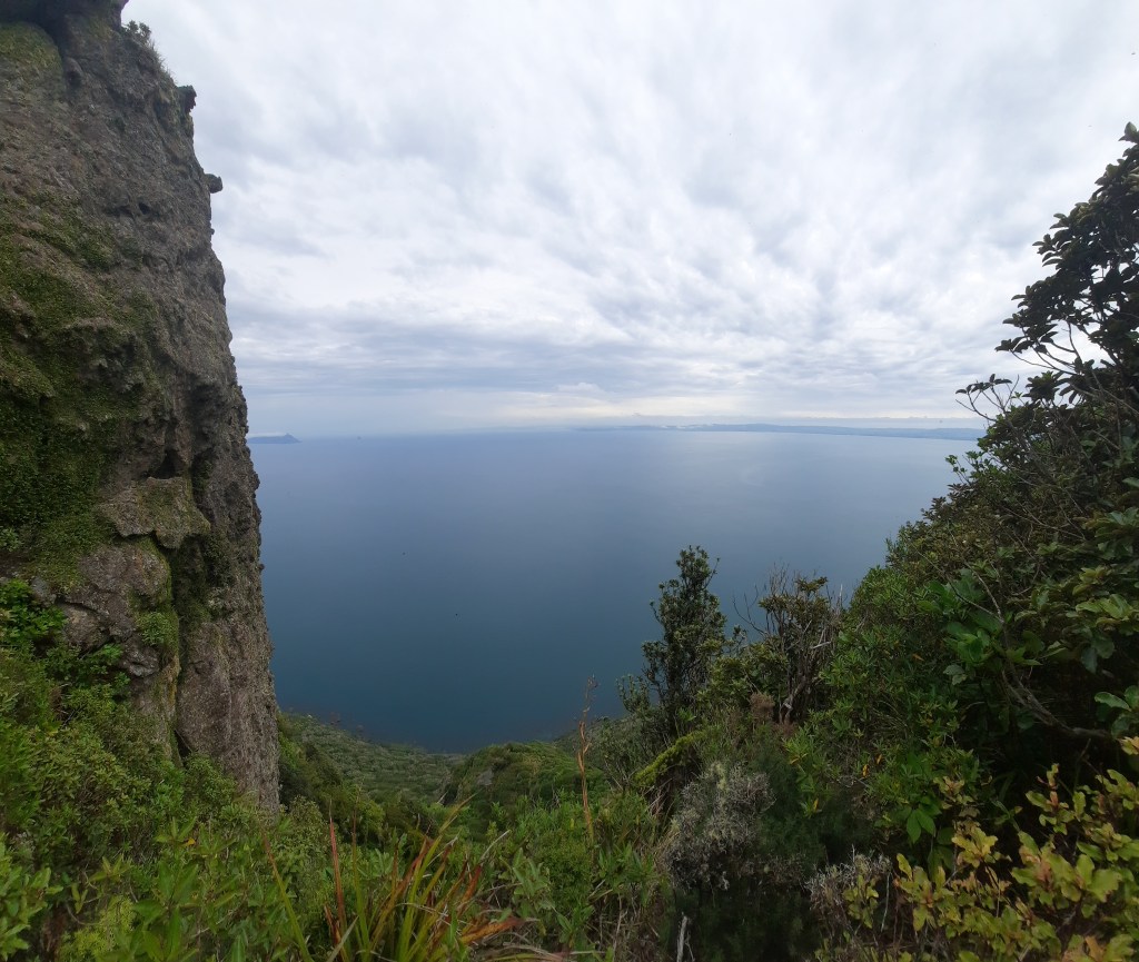
The rock pillar of the Te Whara summit rises a near-vertical 476m above the sea. The Te Whara Track is known as a challenging day walk that follows a 700-year old Māori trail past remnants of Second World War paraphernalia, through thick coastal forest. From Ocean Beach the track climbs steadily uphill across open grassy hillside. For most of the way there are no switchbacks, so it was a challenging ascent. I had drunk a couple of litres of water during lunch and it was all coming out as sweat. On our side was an overcast day and a breeze occasionally. Fiona and Tony were taking the incline better than I was which made me think about how fit I had been when I crossed this same track three years ago. I had been over four months into the walk however. That time it was somewhat difficult, this time it was right out tough. At the many stops to catch my breath, there were clear views out to sea. We arrived at a clearing with picnic table from where you could
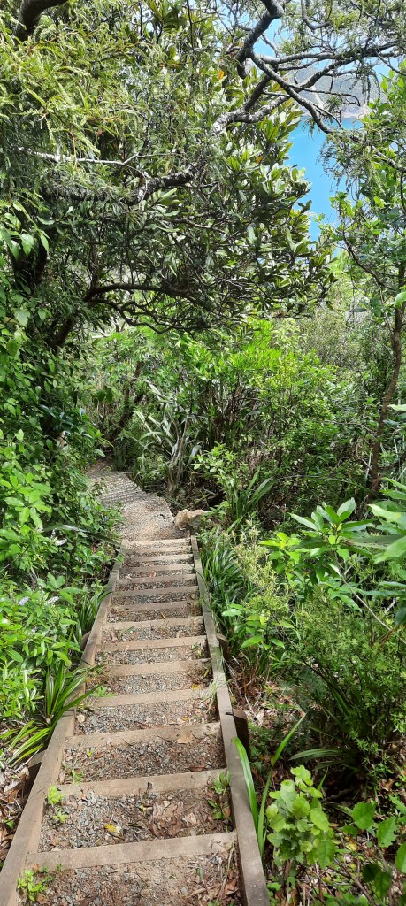
About 45 minutes into the walk, the track arrives in a clearing with a picnic table where you could detour to a wartime radar station. It was built in 1942 to take advantage of the strategic location with a view of all boat traffic passing in and out of Whangarei Harbour. I saw it before so had no intention of taking a detour thank you. Also from this location was an excellent view of the legendary Te Wahine iti a Manaia and the Hen & Chicken Islands out to sea. Hen Island was shrouded in cloud and looked eerily like it should be called Skull Island or something dastardly pirate like. As the trail continued to climb, the coastal rainforest became more impressive, laced with thick supplejack and dense with ancient puriri trees which stretch their gnarled roots across the path. It was like a rockery with many sized rocks and boulders covered in vegetation. Finally the summit of Te Whara was reached. We took the narrow track that veers off to the left and leads to the rock pillar. With sheer drops on three sides, scrambling up the rocky peak isn’t for the faint-hearted but the 360-degree panorama is worth it and after that gut busting climb it needed to be. From our new vantage point we could look down and across to the next few days walk along Bream Bay to Pakiri. The track continues along the apex of the ridge, undulating through the bush. The vegetation changes frequently such as areas of grass nikau kanuka tawa taraire kohekohe kowhai cabbage trees and even kauri. We saw Whangarei Heads daisy spotted a tiny black and white Miromiro or tomtit. Occasional rock formations, remnants of the area’s volcanic past, provided lookout points and rest stops to catch our breath. Each outcrop came with many a set of wooden stairs. We would curse each one and decried why we just couldn’t go round the side. Near the Peach Cove turnoff we crossed the path of a younger group heading for Te Whara. They looked so Famous Five, all chipper and fresh, not a sweat patch in sight. Conversely I was dripping in it from head to toe.
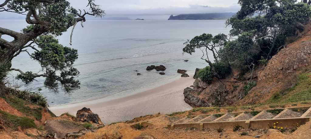
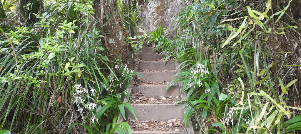
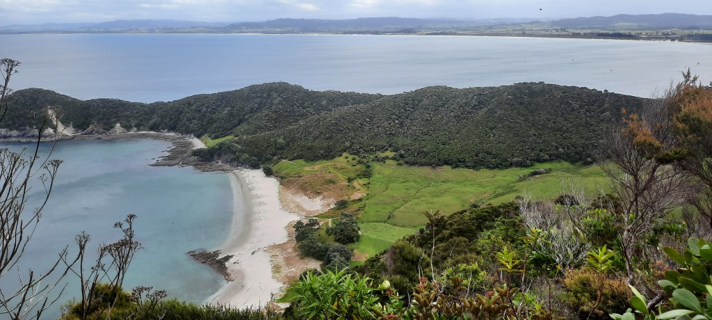
Eventually we reach the ridge of Matariki/Mt Lion at 395m. From this summit, the trail descends steep stairs. There are 1,500 of them – all care being taken with knees and not falling down them. On the way down, the striking ivory crescent of Smugglers Cove made a great distraction from the many steps.


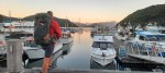
From the bottom of Mt Lion we had another rest. My words “thank beep that’s over” as we dropped our packs and sunk to the grass. We had smashed it though. 3.5 hours instead of 5-6. Relieved it was accomplished. The day wasn’t over yet. We now had a 7 km walk to Reotahi beach, find somewhere to stay tonight and prepare for the trip across the harbour tomorrow. I had texted Blair who has a TA water taxi service and we were booked for tomorrow morning at 8am. Then commenced the trudge along the roadside to our destination. We were tired by this time and just wanted the day to be over. After a few kms I wondered why I didn’t just hitch a ride from Urquharts Bay. Too late committed now so on up the hill to McLeods Bay. It is here that you can make the hike up Mt Manaia. It’s a Great NZ Short walk. I have climbed the 1,000 steps to its summit before so this afternoon it would be no to that idea. Just over the crest of the hill was a beautiful sight – The Manaia Club welcomes walkers. That’s me! I signalled to Fiona & Tony that I was going in for a drink. They would continue onwards instead. Oh that coke and beer were nectar. I sat with a local guy who was once the Publican at the Whangarei Hotel. His sister is married to Neil Finn. The things you find out from strangers over a beer. The lovely bar lady offered me WiFi and to charge my phone which I was grateful for. Soon after I continued on my way feeling decidedly better. It was after 6:30pm when I reached Reotahi and found the camping site. Fiona & Tony were already set up. I pitched my tent as quickly as possible as it was about to rain and crawled inside. I’ll sleep well tonight.


What a climb Mark! Well done you:)
LikeLike