Sun, Mon 14 December – Days 29-30
39 km
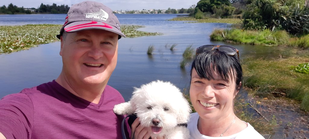
With some free time to enjoy in Hamilton, Heather and I took Ben for a walk around Hamilton Lake and later in the day visited the newly opened Surrealist garden at the Hamilton Gardens. If you haven’t been to these gardens put it on your bucket list. They are creative and inspirational. Fortunately the parking angel found us a spot right at the front so there wasn’t far for us to walk (the irony) to this new addition to the gardens. The highlight is the moving trees, the Alice in Wonderland door and the curled garden edges. We also took in the relatively new (Katherine) Mansfield garden and saw that there are further gardens to be added in the future to the already impressive collection.


Heather and Charlie have been extraordinary hosts to me in Hamilton but it’s time to hit the trail again. The trail angel in Karamu is not currently accepting hikers so I am unsure as to where I will end up tonight? It is really only a half days walk to Whatawhata which seems too short. Yet to get to the campsite at the base of Pirongia is probably more than I want to do in a day. It’s a dilemma as to what to do. But one that I will reassess during the day and it is often better just to ride out the day as you never know what may happen or who you may meet to influence it.
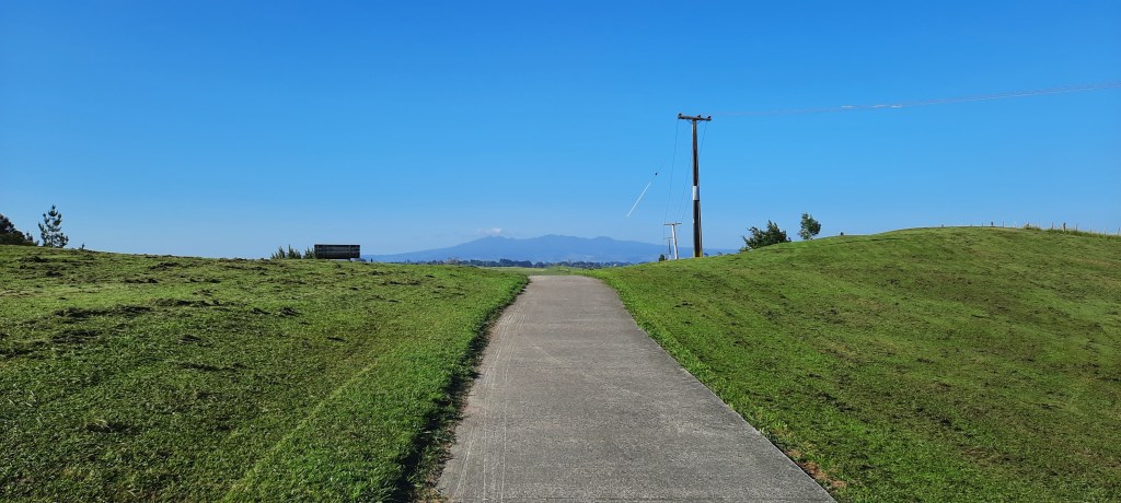
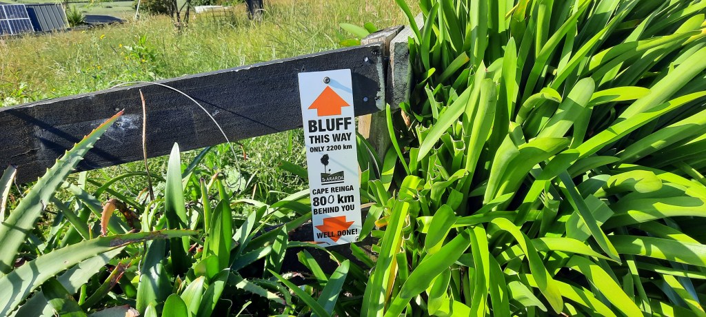
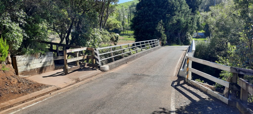
From Tills Landing in Dinsdale the concrete path climbs over a small hill to reveal the first full view of Mt Pirongia in the far distance. Yep it looks really far away. Can I make that in one day I wonder to myself again? Shortly down the road there is a small TA sign congratulating hikers of 800 km accomplished with a mere 2,200 km to go. I’m contemplating the sign when a man emerges from his building site and says it is wrong. He is a section hiker and explains that it was correct when the trail went through the Hunua Ranges. That makes sense as any changes in the route would affect the way markers. At this point now it’s closer to 770 km according to the trail app. A little further on the trail includes the Taitua arboretum, a tree collection that was donated to the council. It is beautifully maintained and has a wonderful array of native and exotic trees in a park like setting. There are many benches and even picnic tables plus also a swag of chickens and roosters. After a short road walk the trail follows a paper road across dairy country. Lots of stiles and crossing through electric fences before reaching the main road leading north into Whatawhata. Fortunately there are some decent berms as the trucks hurtle along this road. At Whatawhata I stop in at the cafe for lunch of coffee panini and a scone. It is before midday so I keep going now with the intention of reaching the campsite.

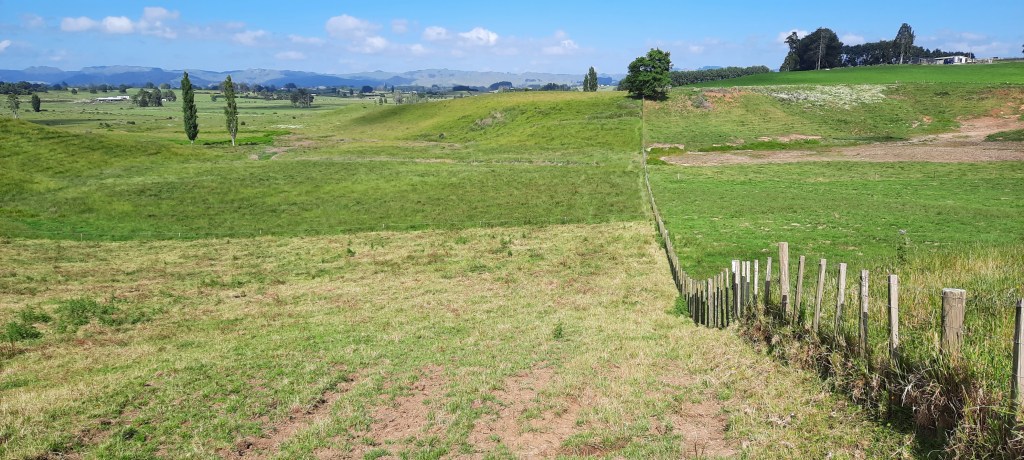
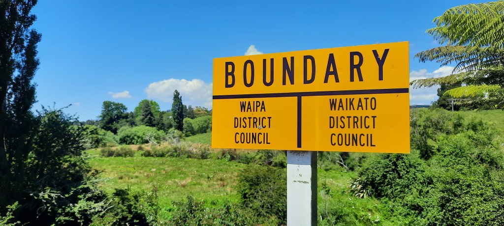
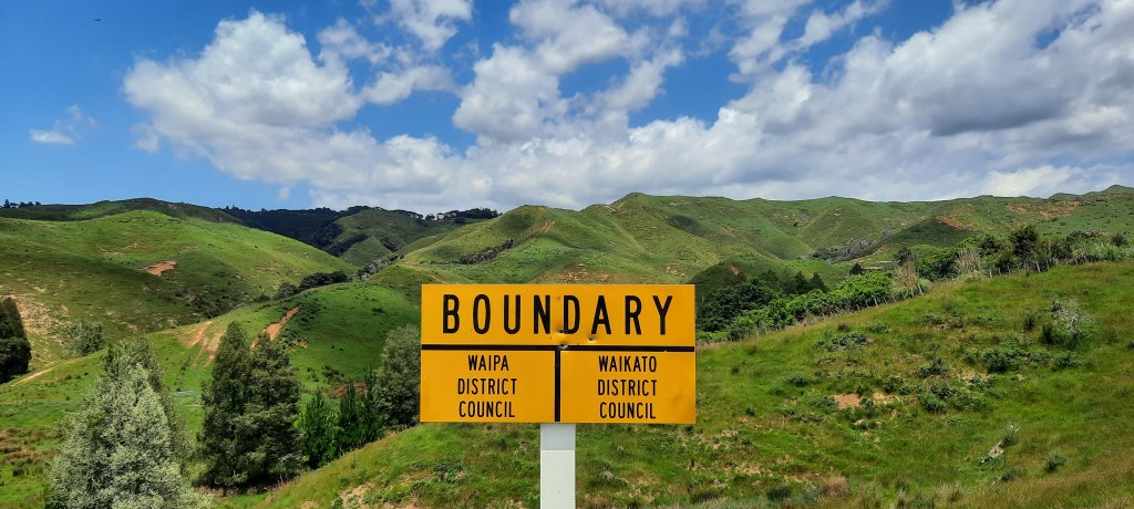
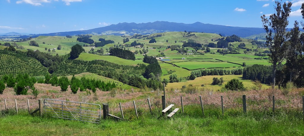
Refreshed I head out again, this time along the main road to Raglan. It’s busy. The draft from a big truck blows my cap off and into a deep drain. The sides are near vertical so I have to ditch my pack to clamber down for it. I’ll hold onto it next time. Luckily the walk on this road is short when the trail turns into Te Pahu Road. I miss the sign that indicates the trail goes off the road and along the river however I can see on my app that it rejoins the road further down so I’ll stick to the road thanks as it is quicker. In subsequent conversations with hikers it appears I am not alone with this small deviation. The road meanders through nice countryside with maize on both sides. Near Old Mountain Rd there is a sign indicating change in councils as I step into Waipa. Old Mountain Road branches off to the right and I follow this for four km from the flats and up towards the limestone peaks. A cyclist stops for a chat after whizzing by me. He’s interested in the TA and had ridden from Cape Reinga down to Bluff in February 2020 – it only took 16 days. Here I am almost a month into my walk and not even near half way. Further up the road I pass another council sign so somewhere back down the road I must have crossed back into Waikato unawares.


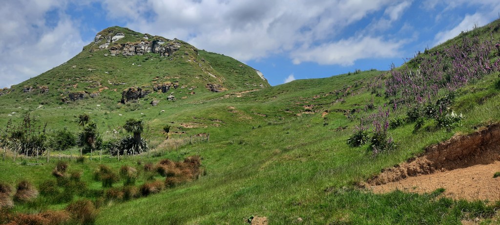
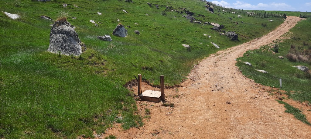
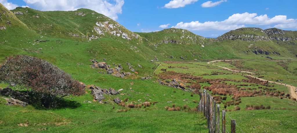
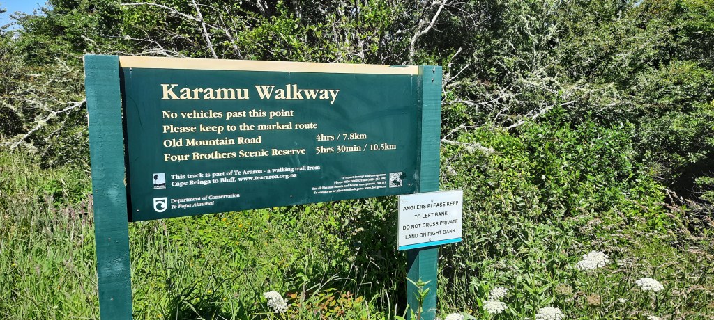
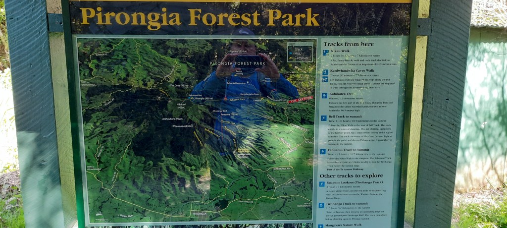
As I walk up the road I’m so engrossed with a helicopter spreading fertiliser that I almost miss the turn off the trail. Not that there was anything to identify it for walkers. No orange triangle, TA signage – absolutely nothing. Usually when crossing a fence there will be a stile too. Not here. I had to climb over the gate which was very securely padlocked. The Karamu walkway commences here along a farm track and paddocks of lambs. The track traverses the highest points of the farm offering the type of scenery that reminds me of childhood after all we did live not too far north of here. I particularly like the limestone cliffs and fallen rocks that the sheep shelter under or around. It is very exposed to the sun however and I could do with some more water. The springs are dry already so I am resigned to doing without any additional water. Then low and behold there is a wooden box on the track. I open it in anticipation and thankfully it covers a water pipe plus it is fitted with a small perpendicular hose with a tap. I can’t believe my luck. Checking the water looks clear I fill my bottle and spray my buff with water as well. It’ll offer cool sun protection around my neck. I give a mental thank you to the farmer for their generosity, whether intentional for hikers or not. When the track reaches an airstrip it sidles off the farm road into a steep sided paddock. A short climb cleverly leads up to a narrow ridge which reveals a grand view of Pirongia in its majesty. From here the trail enters native bush and descends on a 4wd track. I disturb a deer in the bracken which runs off before I can get a photo. I’ve really enjoyed the Karamu walkway today. Now there is a stretch of road walking until the campsite at Kaniwhaniwha. It is a relief when I arrive yet I am feeling surprisingly well given it has been a long walk today. At the camp are two other TA hikers, Steve and Jonathan. Once again I have not met them before. We have dinner together then it’s early night in preparation for scaling Pirongia tomorrow.
The TA app has the camp at 801 km. I can safely say done it now.


Leave a comment