Thurs 23 March 2017
- Km Today: 0
- Total Km: 1072
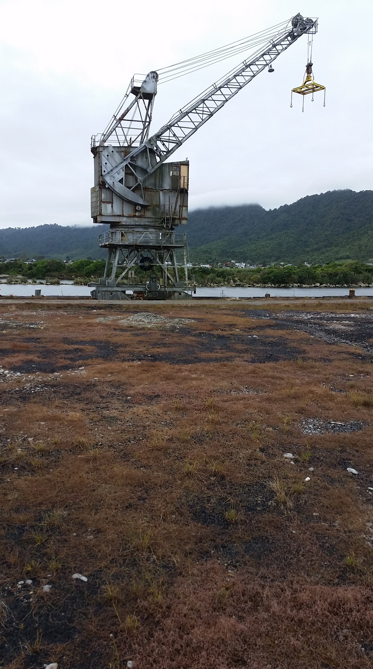
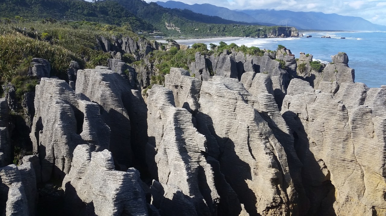
It is sad to say goodbye to Nick this morning as he is returning to Christchurch. Even after one day of having company I know I will miss it when I start walking again. It happens always, however fortunately I quickly get back into the swing of the norm. We drop into Greymouth for a coffee. The town takes its name from the Grey River, and therefore from Sir George Grey. On the way out from Greymouth we stop for a quick look at the port area. Until as recent as 2008 this port was humming with activity as coal was loaded onto ships destined around New Zealand or overseas. Now the main pier is dormant and in disrepair, the rusting gantry cranes standing like forlorn sentrys guarding the abandoned wharf. The coal is railed across the island to Lyttelton port these days. It is not long before we see our first Nikau palms which always remind me of this part of the South Island. It has been said that when the Polynesian ancestors of the Maori arrived in New Zealand they first attempted to find a coconut tree – which in the pacific is a vitally important food plant and serves a great number of practical utilities. Upon discovering the Nīkau they remarked on its similarity but were dismayed to find it lacked the all-important feature of coconuts. Indeed, some translations of the word Nīkau are ‘without nuts’ or ‘coconut barren’ in reference to this fact. Before long we arrive at Punakaiki – the famous Pancake Rocks. They were formed 30 million years ago from minute fragments of dead marine creatures and plants landed on the seabed about 2km below the surface. Immense water pressure caused the fragments to solidify in hard and soft layers. Gradually seismic action lifted the limestone above the seabed. Mildly acidic rain, wind and seawater sculpted the bizarre shapes that give them the pancake appearance which are enjoyed by every backpacker van and campervan laden tourist to visit New Zealand. Many were there today even though we have tried to arrive early. I went into the DOC visitor centre to book my huts for the Heaphy Track and then caught up with the folks on the excellent track which circles the pancake rocks. The tide was out so there was not much in the way of blow hole action today, which can be really spectacular on a high tide with a westerly swell.


We continue north towards Westport and take the turnoff towards Cape Foulwind to see the lighthouse and cross the landcorp dairy farms. There is a coastal walkway at Cape Foulwind with views up and down the coastline. We opted for the shorter walk to the lighthouse as we have been here on a previous trip to the south island. The road to Westport passes the cement works which closed in 2016 after 58 years of cement production. It was the largest employer in Westport. Once in Westport we had lunch at the excellent PR’s Cafe on the main street and then went to find the local St John station. There we met with the delightful Sarah to find out about the local territory and a photo op of course. We still had a way to travel however so got on the Karamea Highway north along the exceptional coastline through towns such as Granity and Hector. The road turns inland over the Karamea Bluffs offering widespread views of the coast and out to sea. Tonight we stay at the Last Resort in Karamea. There is a power cut for a short while this afternoon but it doesn’t hinder us doing a load of washing before dinner. Tomorrow the Heaphy!


Leave a comment